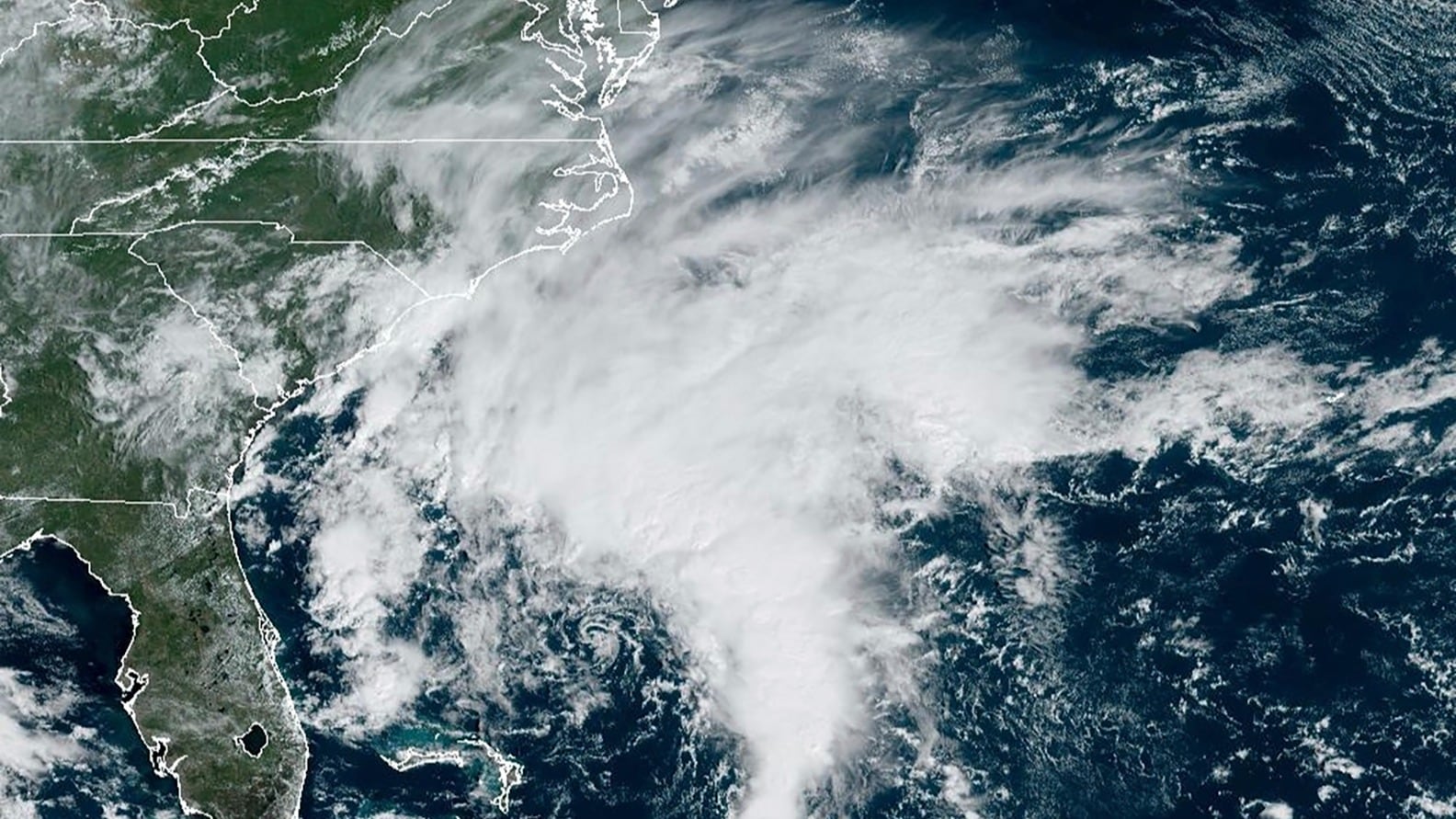
A storm churning in waters off the eastern U.S. has increased to tropical storm strength and is forecast to reach the North Carolina coast Friday morning, the National Hurricane Center said.
The storm was off the coast of South Carolina and North Carolina late Thursday with top sustained winds of 40 mph (65 kph). A storm surge watch was in effect, with surges between 3 and 5 feet (91 centimeters to 1.5 meters) forecast for parts of North Carolina, the center reported.
As of Thursday night, the storm was located about 355 miles (570 kilometers) southeast of Charleston, South Carolina, and about 395 miles (635 kilometers) south Cape Hatteras, North Carolina, and moving north at 3 mph (6 kph), the center said.
Though the system had reached tropical storm strength, it was yet to be given a name and the center was still referring to it as Potential Tropical Cyclone Sixteen on Thursday night. The hurricane center defines a potential tropical cyclone as a disturbance posing a threat of tropical storm or hurricane conditions to land within 48 hours.
Meteorologist Maria Torres, a public affairs officer with the Miami-based center, said people along the Atlantic coast need to watch the storm’s progress, gather supplies and make preparations for its arrival.
“This will bring some tropical storm force winds and storm surge along with the high winds to the East Coast through the weekend, mainly from the Southeast to the Mid-Atlantic states,” she told The Associated Press.
The tropical storm warning was in effect from Cape Fear, North Carolina, to Fenwick Island, Delaware. It also includes the Chesapeake Bay south of North Beach, Tidal Potomac south of Cobb Island and Albemarle and Pamlico Sounds. Storm surge warnings were in effect for areas throughout the region, the hurricane center said.
Virginia emergency management officials warned of heavy rain, high winds and flooding in the next few days.
The Virginia Department of Emergency Management said on social media Thursday that officials are coordinating with local weather service offices to watch the system developing off the coast. Officials called on residents to prepare for the storm and impacts on the region throughout the weekend.
North Carolina Emergency Management warned large swells from distant Hurricane Nigel also would reach the state’s coast on Thursday, boosting the rip current risk. The combination of those swells and the low-pressure system could mean additional ocean overwash, beach erosion and coastal flooding.
The hurricane center said storm surge between 2 and 4 feet (0.6 to 1.2 meters) was expected.
A storm surge warning was in effect from Duck, North Carolina, to Chincoteague Virginia, including Chesapeake Bay south of Windmill Point, and for the Neuse River, the Pamlico River, and portions of Pamlico Sound.
A storm surge watch also was issued from Surf City in North Carolina to Duck, North Carolina, along with Chesapeake Bay north of Windmill Point to Smith Point, the Tidal Potomac south of Colonial Beach and Albemarle and the remainder of Pamlico Sound.
Meanwhile, Hurricane Nigel was headed toward cooler North Atlantic waters as a Category 1 storm. The hurricane center said Nigel was expected to become “extratropical" and was centered about 700 miles (1,125 kilometers) northwest of the Azores.
Nigel's maximum sustained winds reported in the center's most recent update late Thursday were 75 mph (120 kph). There were no coastal watches or warnings associated with Nigel.
Updated Sept. 22 at 4:17 a.m. ET with the latest details.